

As the leaves transition from shades of green to amber and crimson, and the air takes on the crisp edge of autumn, there is no better time to venture along one of Oakland County’s many scenic trails.
Wilder Side | Walk Slowly, Stop Often, and Listen
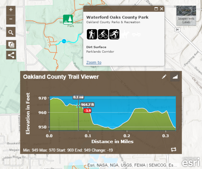
Navigate your next trail adventure with the help of the Oakland County Trail Viewer: an interactive map developed by Oakland County’s award-winning GIS team. Each trail is marked by brown lines, while green icons represent parks. When a trail is selected, the map allows you to reference both its length and elevation. When users click on a green park icon, its name, size, website, and other helpful information appear.
Make the most of your fall and use the map and our full list of trails to find one near you!
Like what you see? Visit the Oakland County website, and follow us on Facebook, Twitter, Instagram, and Pinterest for more news year round. Join the conversation using #OaklandCounty.